Fighting Clouds On A Warm Humid Long Island Monday
Rain Arrives Later Tuesday Into Wednesday
WEATHER IN 5 PODCAST MONDAY 9/28/2020
SUNDAY MORNING 9/27/2020 JOE & JOE WEATHER SHOW PODCAST
Warm humid conditions cover Long Island this afternoon. Temperatures are in the 70s. It is definitely sticky outside. The sun is attempting to break through the low and middle clouds that are around. This is a typical end of September day where summer is trying to hang on before the realities of the Autumn season take hold. A cold front is approaching that will stall out and that sets us up for a solid soaking rain later Tuesday into early Wednesday. The southerly flow for now is only producing a few widely scattered showers on the regional radar across the Northeast and Northern Mid Atlantic states and we should stay rain free overnight into Tuesday morning. Lows will be in the 60s.
SATELLITE
REGIONAL RADAR
Just about all of Long Island has seen no rain for 17 straight days. This is a rather long streak without measurable rain and Eastern Long Island is experiencing moderate drought conditions right now. The rains coming should help. Tuesday morning will be cloudy and then as the day wears we should see increasing showers and downpours.
The bulk of the rain will come Tuesday night into Wednesday morning before a cold front moves offshore. The idea of a second wave of rain appears off the table and weather conditions should start to improve later in the day on Wednesday. If a thunderstorm or two can get into the mix rainfall amounts should be in the inch and a quarter to inch and three quarters range.
Once this weather system finally gets out of here we will turn much cooler. In fact we will be in a cooler than normal weather pattern from midweek onward into the long range with below average temperatures in the cards through early next week at least. We should see some sun and clouds Thursday with highs in the 60s to around 70 degrees or so. Another weaker cold front arrives Thursday night.
Behind the front is even cooler air that sets up for Friday and the weekend. We should have mainly dry weather conditions Friday through Sunday with some sunshine each day but it is going to be cool. Highs by day will be in 60s with nights in the 40s to near 50 and probably 30s in cool spots.
WATCHING THE TROPICS THIS WEEKEND
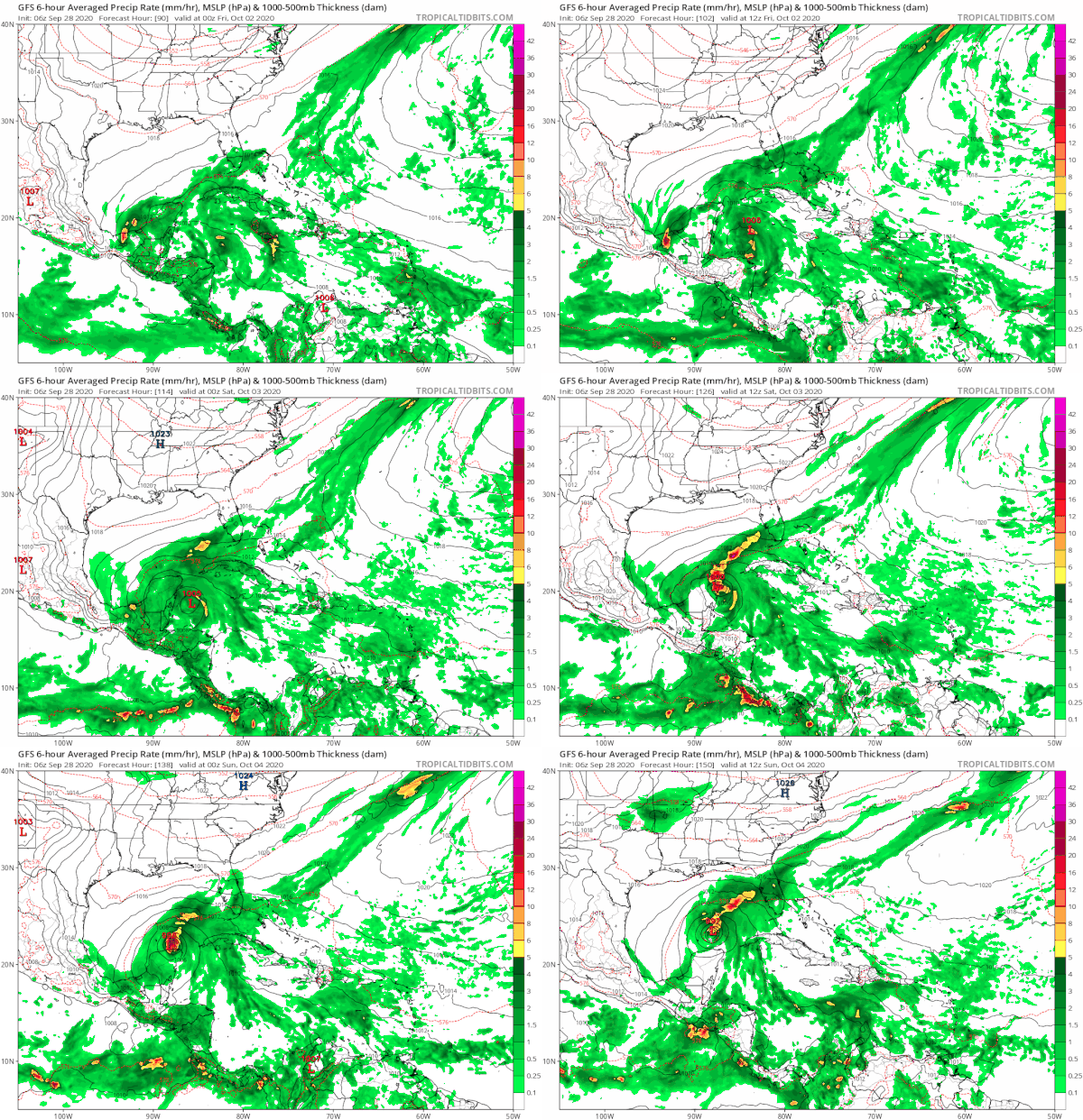
While the Eastern US turns cooler thanks to a strong trough in the Eastern US south to the Gulf States it creates a condition of lower than normal pressures in the Northwest Caribbean. Conditions there will be favorable for Tropical Storm development this weekend and whatever forms will likely emerge into the Gulf of Mexico though once there the longer range is a bit muddled regarding outcome. As always with these things it is wise to wait for something to actually develop before we begin to worry about it.
MANY THANKS TO TROPICAL TIDBITS FOR THE USE OF MAPS
Please note that with regards to any tropical storms or hurricanes, should a storm be threatening, please consult your local National Weather Service office or your local government officials about what action you should be taking to protect life and property.


