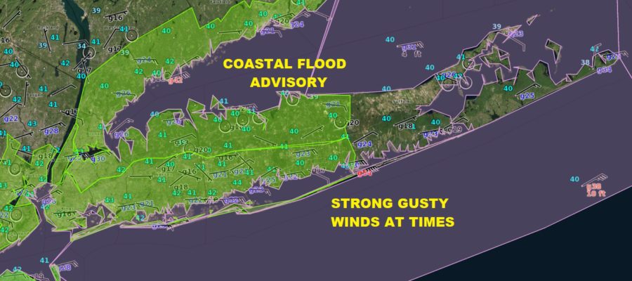
Coastal Flood Advisory Windy Miserable Sunday Heavy Rain Into Monday
Coastal Flood Advisory Windy Miserable Sunday
Heavy Rain Into Monday

The big high to the north is pressing southward against the lower pressures to our south and the major spring storm to the west. The result is a ton of cloud cover, temperatures in the upper 30s and lower 40s this morning and a howling northeast wind which will be with us for most of the day. Don’t expect much in the way of rain today though there could be some spotty light rain or drizzle. Also don’t expect temperatures to go anywhere today as they are likely to sit just where they are into tonight.
US SATELLITE


Radar is not picking up on much this morning though some light rain and drizzle may fall under the radar today. To the north on the regional radar we can see freezing rain falling across upstate NY where ice storm conditions continue to developing long I-90 west of Albany toward Rochester & Syracuse. Those conditions will worsen there but we will be above freezing here so no worries.

The next item on the agenda could be some rain from the south coming up this evening as the HRRR model shows. This is yesterday’s cold front turning around as tonight’s warm front and begins to move northward.
HRRR FORECAST 6PM SUNDAY

Monday morning into the afternoon that cold front swings east so temperatures will rise into the 50s Monday and look for heavy rain developing during the early morning hours on Monday (probably before daybreak) and lasting into the afternoon. Strong winds and thunderstorms are likely and it looks like we could get a couple of inches of rain out of this. The morning commute Monday will not be a nice one.
..COASTAL FLOOD ADVISORY REMAINS IN EFFECT FROM 10 PM THIS
EVENING TO 2 PM EDT MONDAY...

* LOCATIONS...Vulnerable locales along Western Long Island Sound.

* TIDAL DEPARTURE...1 1/2 to 2 ft above astronomical tides
  Sunday Night, and 2 to 2 1/2 ft above late Monday morning into
  Monday afternoon.

* TIMING...Minor coastal flooding with the Sunday Evening and
  Monday morning tidal cycles.

* COASTAL FLOOD IMPACTS...Shallow flooding is expected in the
  most vulnerable locations near the waterfront and shoreline.
  Expect 1 to locally 2 feet of inundation above ground level in
  low lying, vulnerable areas. Some roads and low lying property
  including parking lots, parks, lawns and homes/businesses with
  basements near the waterfront will experience shallow flooding.

* SHORELINE IMPACTS...3 to 5 foot breaking waves will result in
  locally moderate coastal flooding along shoreline roadways and
  properties, with minor damage possible to shoreline structures.

PRECAUTIONARY/PREPAREDNESS ACTIONS...

A Coastal Flood Advisory indicates that onshore winds and tides
will combine to generate flooding of low areas along the shore.