Extreme Heat Eases Thanks To South Wind
Extreme Heat Eases Thanks To South Wind
When you are in the throws of an extremely hot air mass you look for anyway to cool off. We mentioned over the weekend that the south wind could come into play on Monday and thankfully for areas south of the Long Island Expressway and the East End of Long Island it has! We saw temperatures today reach 90 to 95 by noon today and it seemed like we were on our way to 100 but the south wind kicked in on schedule and that at least put a halt to the temperature rise and in some places it knocked the temperature down quite nicely. Unfortunately the humidity remains just awful and it will be very high all week so it will still feel like a steam bath.
NYZ177-179-078>081-022200-
Long Island New York 5PM Observations

CITY           SKY/WX    TMP DP  RH WIND       PRES   REMARKS
Jones Beach      N/A     81 N/A N/A SE10        N/A
Wantagh          N/A     86  72  62 SE9         N/A  HX  92
Hempstead        N/A     88  70  55 SE9       30.07F HX  92
Matinecock Pt    N/A     90 N/A N/A S7G13       N/A
Farmingdale    FAIR      88  69  53 S12       30.05F HX  92
MacArthur/ISP  FAIR      86  72  62 S9        30.05F HX  92
Stony Brook      N/A     90  72  55 S6          N/A  HX  96
Shirley        FAIR      83  75  77 SE10      30.06F HX  90
Mt Sinai Harb    N/A     90 N/A N/A S7          N/A
Westhampton    FAIR      80  71  74 SE9       30.09F
East Hampton   FAIR      79  71  77 SE9       30.07F
Southold         N/A     82  72  69 S10         N/A
Montauk          N/A     79  72  79 VRB5      30.09F
$$
We are seeing cloud free conditions across Long Island this evening and overnight with the persistent south to southeast wind though light, we could see some patchy dense fog developing over coastal areas and over the East End.
EASTERN SATELLITE LOOP


Over the next few days the south wind will be playing a role in keeping temperatures off extreme levels so we could see highs in the 80s to near 90 in the warmest spots and 70s along the shore. Also there is the chance beginning on Tuesday for pop up thunderstorms. The problem with all this is that either alternative brings with it very high humidity and that will be a constant all week. Also nighttime and morning hours going forward will mean patchy dense fog develops along the South Shore coast and over the East End but it does burn off by mid morning.
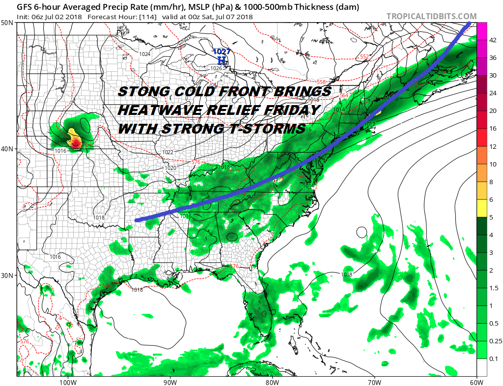
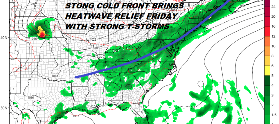
Real relief comes Friday as a strong cold front moves through with the possibility for strong thunderstorms. The result will be a change in air mass for the weekend with lots of sunshine both Saturday and Sunday with low humidity and highs in the 70s to near 80. This will be a nice payoff to the heat and humidity of this week.
NATIONAL WEATHER SERVICE SNOW FORECASTS
LATEST JOESTRADAMUS ON THE LONG RANGE