
Long Island Warm Up Before Rain Tuesday Colder Late Week Snow Ice Rain

Long Island Warm Up Before Rain Tuesday Colder Late Week Snow Ice Rain

Long Island saw temperatures bounce a little today as we finished above freezing. We had sunshine and less wind and now we go into the night with clear skies as shown on the satellite picture below. A west wind will take over tonight and that should keep lows from getting too out of hand. We will likely be at least 5 to 7 degrees higher Monday morning then we were Sunday morning as most lows will be in the mid to upper 20s though some cold spots could get lower if the wind should drop off.
SATELLITE

There are no issues tonight with the satellite showing little in the way of clouds to the west and south and both the local and regional radar are nice and quiet and they should remain so through Monday. A west to southwest wind and sunshine should take temperatures into the 50s Monday afternoon but local sea breezes will develop along south facing shorelines knocking temperatures down slightly into the 40s during the late morning and afternoon especially at the beaches.
WEATHER RADAR


Tuesday brings clouds and rain as low pressure heads from the Southern Plains to the Eastern Great Lakes and Northern New England. It will be into the 50s temperature wise. Rain on Tuesday will be spotty but a steadier rain arrives late in the day and will be gone by Wednesday morning. Look for decreasing clouds from west to east. 60s will be reached in Nassau and Western Suffolk where some sunshine should develop but on the East End it will stay in the cooler 50s due to it taking longer to clear out.

Cold air returns Wednesday night and by Thursday morning we will see lows in the 20s to near 30. Thursday look for sunshine giving way to arriving clouds as the next storm system heads our way from the southwest. Highs will be in the middle to upper 30s.
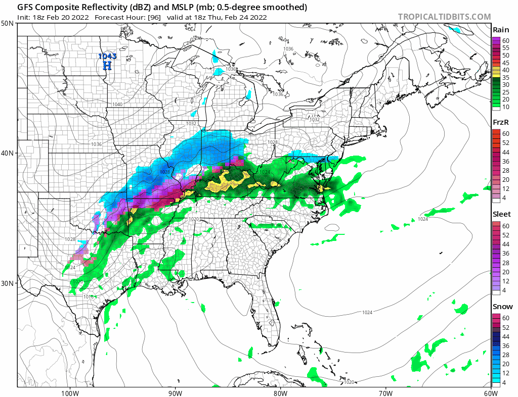
Each of these storms beginning with the one last Thursday is forcing the storm track further southeast. Coupled with a change in the weather pattern across Canada brings us the chance for snow and ice this time around. Ultimately it is about the cold high to the north the builds east and south and how much of that cold air bleeds southward. I don’t think we will know that until we get to Wednesday or Thursday. Today’s models moved around a little. Some were a little colder. Some were a little warmer but not enough to give us any confidence on which way this is going to go. For now we will see there is the risk for snow developing Thursday night and then mixing and/or changing to sleet/rain Friday morning before it ends. If enough cold air gets in here then there is the chance for accumulating snow but we will wait for midweek for the answer to that particular question. The pattern remains active and there is a chance for another storm system to head our way late next weekend. Stay tuned!
BE SURE TO DOWNLOAD THE FREE METEOROLOGIST JOE CIOFFI WEATHER APP &
ANGRY BEN’S FREE WEATHER APP “THE ANGRY WEATHERMAN!
MANY THANKS TO TROPICAL TIDBITS & F5 WEATHER FOR THE USE OF MAPS
Please note that with regards to any severe weather, tropical storms, or hurricanes, should a storm be threatening, please consult your local National Weather Service office or your local government officials about what action you should be taking to protect life and property.
