
Winter Storm Watch Suffolk County Snow Wind Thursday Brutal Cold Friday Weekend

Winter Storm Watch Suffolk County Snow Wind Thursday
Brutal Cold Friday Weekend
Winter Storm Watch is now posted for Suffolk County but not at this time for Nassau County. A major ocean storm will be tracking just to our southeast on Thursday putting Suffolk County in the zone for heavy snow and very strong winds on Thursday. Right now I am thinking that snow on Long Island will be in the 4 to 6 inch range with the possibility of higher amounts to the east.

This is a very powerful storm that will produce hurricane force winds offshore. It will also pull down air so cold that it will actually be colder than the last two air masses! We may see temperatures below zero this weekend on Long Island with highs barely back into the teens.

The energy that will produce this coastal storm is dropping southeastward from the Great Lakes as well as a second area of energy moving across the lower Mississippi Valley. This will cause a storm to form off the Florida coast and then it will intensify rapidly as it moves northeastward up the coast. The track of the storm is just barely offshore and there is some wiggle room in either direction. Models have continued to trend westward and another westward jog could mean higher snow amounts. But before that no weather issues tonight with lows in the teens and Wednesday we will see arriving clouds with highs in the upper 20s to near 30.


Long Island Eastern Connecticut Could See The Worst of It
Make no mistake this is going to be a major Atlantic Ocean storm that will be moving up the East Coast just offshore. We are making no changes to our snow forecast from earlier at this point but it might become necessary to raise numbers to the east of New York City on Wednesday given the incredibly intense nature that this storm is going to take on.
RGEM MODEL CLICK TO ANIMATE
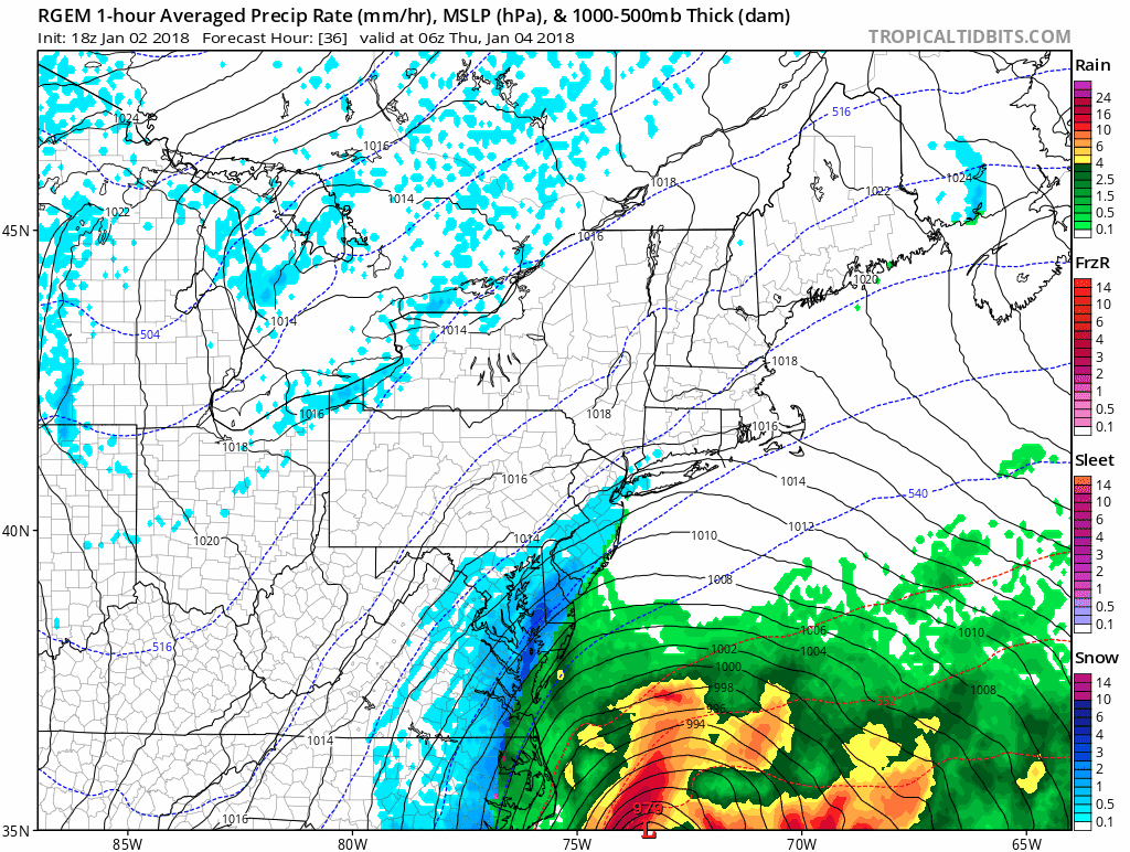
Take a look at how incredibly intense this storm gets with pressures as low as a category 3 hurricane. The radar shows a sledge hammer of snow over Suffolk county around midday Thursday. What probably keeps the snow accumulations from getting too out of hand is the fast movement so there won’t be a lot of time to put down crazy amounts.
RGEM WIND FORECAST CLICK TO ANIMATE
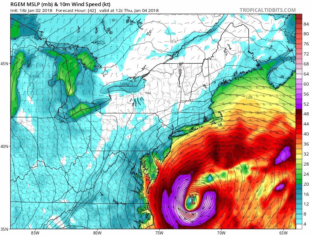
The bigger issue here may be the wind and the outrageous cold air mass that follows. During the peak of the snow fall winds in Suffolk County will be gusting to 50 mph or more and this will create blizzard conditions with heavy snow falling and visibility near zero. For areas to the west the battle will be figuring out the sharp cutoff of the snow and amounts decrease considerably west of New York City. The air this weekend will be brutal. Temperatures will be below zero for lows Saturday and Sunday morning. Highs in some places Friday and Saturday may not make it out of the single digits in some places. This is winter weather to an extreme.
FiOS1 News Weather Forecast For Long Island
FiOS1 News Weather Forecast For New Jersey
FiOS1 News Weather Forecast For Hudson Valley
NATIONAL WEATHER SERVICE SNOW FORECASTS
LATEST JOESTRADAMUS ON THE LONG RANGE
Weather App

Don’t be without Meteorologist Joe Cioffi’s weather app. It is really a meteorologist app because you get my forecasts and my analysis and not some automated computer generated forecast based on the GFS model. This is why your app forecast changes every 6 hours. It is model driven with no human input at all. It gives you an icon, a temperature and no insight whatsoever.
It is a complete weather app to suit your forecast needs. All the weather information you need is right on your phone. Android or I-phone, use it to keep track of all the latest weather information and forecasts. This weather app is also free of advertising so you don’t have to worry about security issues with your device. An accurate forecast and no worries that your device is being compromised.
Use it in conjunction with my website and my facebook and twitter and you have complete weather coverage of all the latest weather and the long range outlook. The website has been redone and upgraded. Its easy to use and everything is archived so you can see how well Joe does or doesn’t do when it comes to forecasts and outlooks.
Just click on the google play button or the apple store button on the sidebar for my app which is on My Weather Concierge. Download the app for free. Subscribe to my forecasts on an ad free environment for just 99 cents a month.
Get my forecasts in the palm of your hand for less than the cost of a cup of Joe!
